 


.gif)


|
Signature Sponsor

March 7, 2018 - Created by Congress on March 3, 1879, the U.S. Geological Survey was originally dedicated to exploring the geology and mineral potential of western lands, but over its 139-year-history, it has evolved to dramatically expand our knowledge of natural science.
Check out some great facts about USGS to commemorate 139 years of scientific inquiry and advancement for the benefit of the American people.
USGS revolutionized surveying. Before USGS was formed, most mapping in the United States was done by military expeditions and several independent government surveys. Upon its creation, USGS established a more comprehensive approach to surveying and worked to classify public lands — examining their geological structure, mineral resources and products. This scientific appraisal of land potential and mineral resources changed the way government approached surveying and encouraged conservation, economic expansion and more efficient development across the nation.
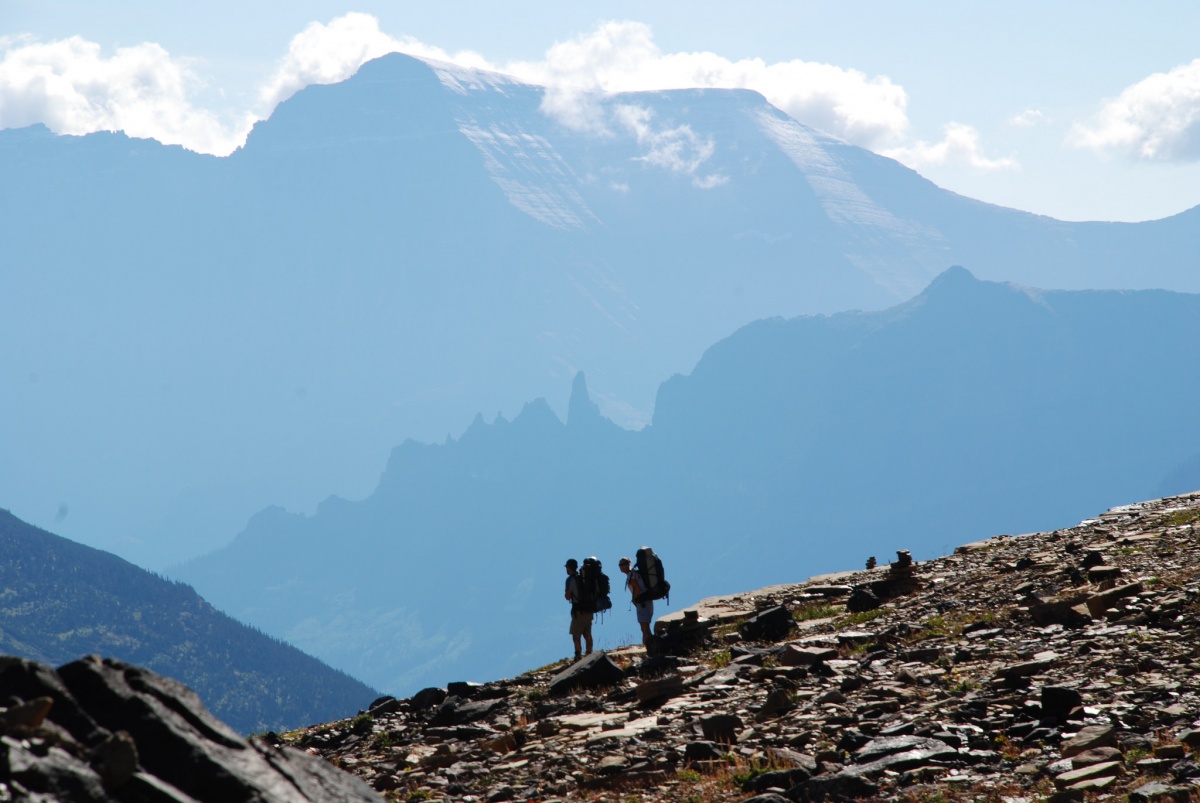
A USGS survey crew studying the alpine ecosystem of Glacier National Park in Montana. Photo by Greg Pederson, USGS
USGS is dedicated to expanding our scientific knowledge of the Earth. This means the Survey is the go-to expert for natural science information and data. USGS serves the country by providing reliable scientific information to describe and understand the Earth. USGS’s scientific work helps minimize loss of life and property from natural disasters, and aids in the measuring and research of water, biological, energy and mineral resources. USGS focuses its work around its key mission areas including ecosystems, energy and minerals, environmental health, natural hazards and water.
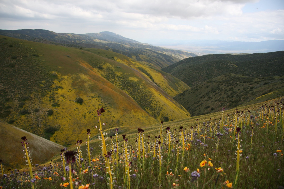
The San Andreas fault runs through Carrizo Plain National Monument in California. The San Andreas is the “master” fault of an intricate fault network that cuts through rocks of the California coastal region and is the epicenter of some of the state’s most famous earthquakes. Photo by Bob Wick, Bureau of Land Management
USGS was essential during the World Wars. When World War I started in 1914, USGS immediately increased its geologic mapping to aid the discovery of new oil fields and needed war materials. When Europe was in urgent need of American agricultural and industrial products — along with steel, copper and explosives — the U.S. was able to provide them, thanks in part to USGS. Working with allies, the search for minerals expanded to Central and South America, and with USGS’s expertise in surveying, adequate supplies of essential materials were found to support the war effort. USGS also started mapping foreign areas for the military. In both World War I and World War II, USGS focused its energies toward the war effort and emerged as a world leader in mineral assessments, both domestic and foreign, and its data was used to solve a variety of industrial and transportation problems.
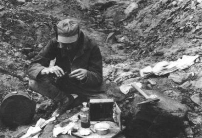
Geologist searching for nitrates in 1917. By the time America entered the war, the USGS had dedicated almost all of its efforts to war purposes. Photo by USGS
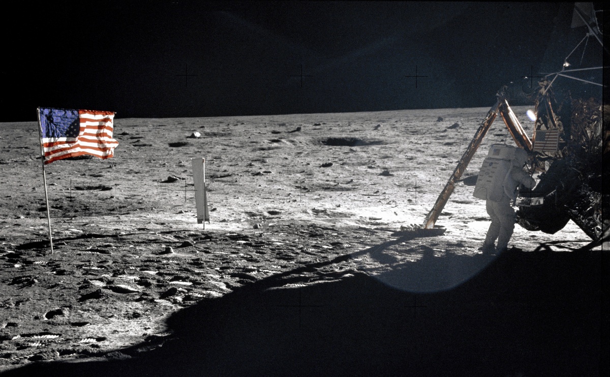
The Space Race’s unsung hero is USGS. After Soviet scientists launched Sputnik — the world’s first artificial satellite — into space in 1957, USGS entered the uncharted territory of space. In the pursuit of studying the geology of the planets, USGS scientists cooperated with NASA to expand our scientific knowledge beyond Earth. In 1959, the Survey compiled a photogeologic map of the Moon and began to study its impact craters and unique minerals. Two years after President John F. Kennedy’s 1963 proposal to “land a man on the moon and return him safely to earth,” USGS and NASA began to train the Apollo astronauts in geology and how to investigate and evaluate methods and equipment for geological and geophysical exploration of the Moon.
Astronaut Neil Armstrong during the Apollo 11 mission on the lunar surface. NASA and USGS worked closely to accomplish this scientific breakthrough. Photo by NASA
USGS didn’t invent topographic maps, but it did perfect them. The USGS National Geospatial Program provides scanned historical topographic maps from 1884-2006 and current maps that are created using digital geographic information systems. Great for scientists, students, companies and campers, this easy-to-use map called US Topo provides a unique opportunity to study our nation’s topography. Today, USGS is the nation’s largest civilian mapping agency, creating and distributing maps of more than 3 billion acres of lands and waters. Check out the growing database to explore the diversity of nationally protected lands.
This map shows protected areas in the United States. USGS has been creating maps like this since the 1880s. Photo by USGS
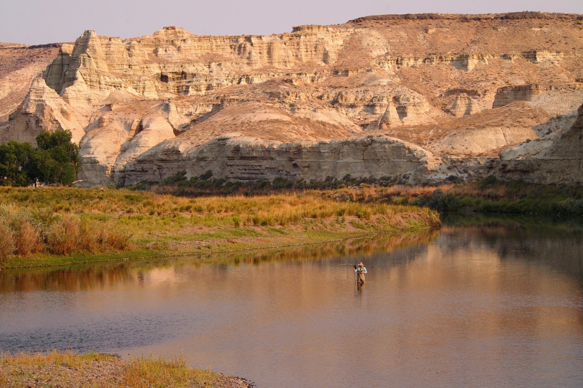
USGS monitors one of our nation’s most important resources — water. There’s a good chance that the water you’re drinking has been monitored, tested or studied by USGS. USGS works to collect important data, like water quality and stream trends, to help predict and prevent local losses of life and property. USGS’s real-time streamflow map allows individuals to monitor the streamflow conditions of rivers across the country.
USGS hydrotech, Alvin Sablan, can be seen here using a streamgage in the Owyhee River near Rome, Oregon. Photo by John Wirt, USGS
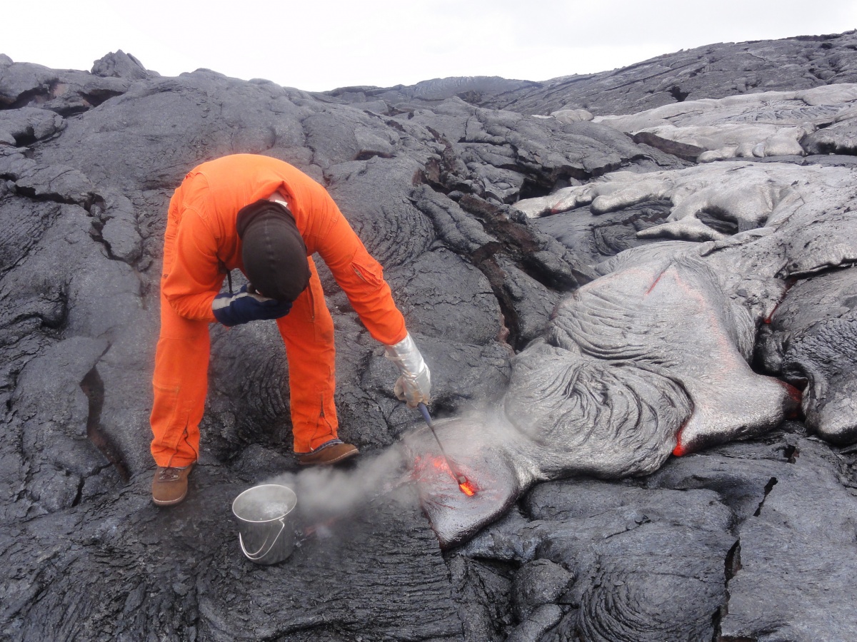
Worried about volcanoes? USGS is on the case. With 169 potentially active volcanoes in the U.S., the work of the Volcano Hazards Program is essentially to keep Americans safe. Through this program, USGS scientists research how volcanoes work so they can issue timely warnings and provide the public with the best scientific information possible. USGS works to conduct natural hazards research to provide policymakers and the public with the information they need to save lives and billions of dollars with preparedness and response strategies. USGS operates five active volcano observatories: Alaska, Cascades, California, Yellowstone, and the Hawaiian Volcano Observatory.
A USGS scientist in Hawaii collects lava samples for chemical analysis, which can give insight into changes in the magmatic system. Photo by USGS
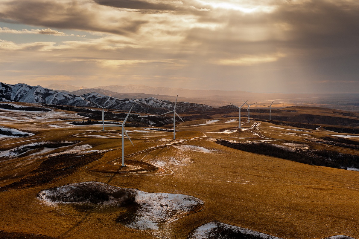
USGS provides cutting-edge energy research. USGS studies the locations and quantities of energy resources, as well as evaluates the environmental and economic impacts of exploring and extracting oil, gas, coal and critical minerals. From identifying the next source of geothermal energy to estimating the amount of recoverable natural gas, the research done by USGS provides the framework for future U.S. energy growth and coming challenges to production.
Wind farm in Idaho. Photo by Bureau of Land Management
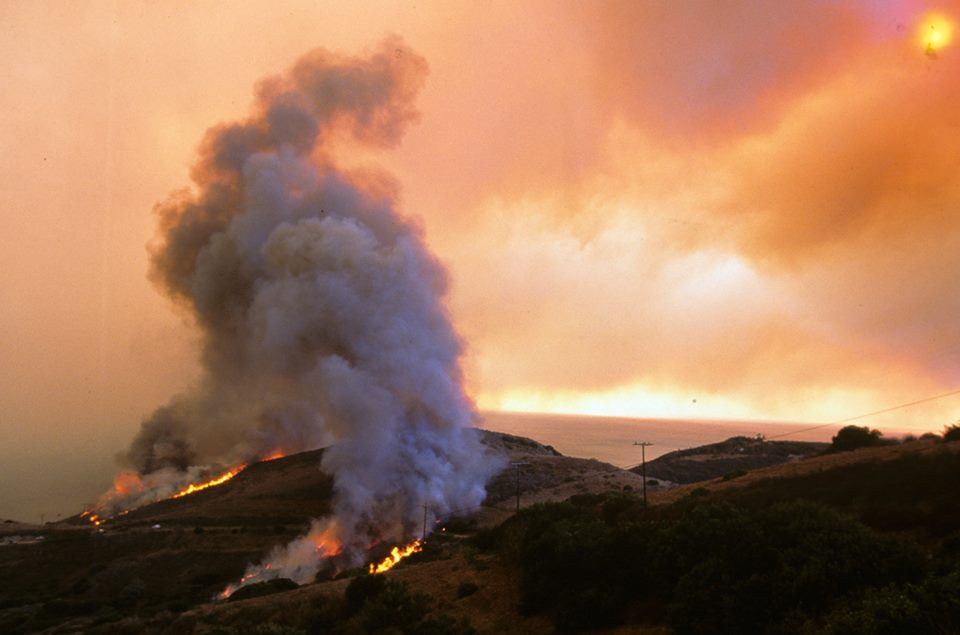
USGS is helping first responders keep tabs on wildfires. During the 2017 fire season, over 10 million acres of wildland were scorched by wildfires. USGS’s GeoMAC is a one-stop shop for tracking fires, aiding first responders, emergency managers and even communities near an active fire. It was the first wildfire tracking system of its kind, and now millions of people use the application each year. Check out GeoMAC to track the location and intensity of current wildfires, and learn about previous fires back to 2002.
Wildfires are common in Southern California. USGS studies ecological factors, like invasive grasses, that increase the risk of wildfire damage to homes, lives, roads and other infrastructure. Photo by USGS
CoalZoom.com - Your Foremost Source for Coal News |


|
.jpg)